
Scientists are warning that a “super” El Niño weather event could be developing in the Pacific Ocean, with forecasters predicting it may become one of the strongest climate phenomena of the century, potentially rivalling or exceeding the devastating 1997–1998 episode.
NOAA’s Climate Prediction Center, in its advisory issued on 9 May, confirmed that El Niño is likely to emerge between May and July 2026, with a 61% probability of onset during that window, and is expected to persist into next year. The World Meteorological Organisation’s (WMO) latest Global Seasonal Climate Update is in broad agreement, signalling a clear shift in the equatorial Pacific and pointing to El Niño conditions emerging as early as May–July 2026.
According to NOAA’s Climate Prediction Center, there is approximately a one in four chance that the phenomenon could develop into a “very strong El Niño”, with sea surface temperature anomalies exceeding 2.0°C above historical averages in the tropical Pacific’s Niño-3.4 region during the upcoming Northern Hemisphere winter.
What causes El Niño
El Niño is a naturally occurring climate pattern resulting from complex interactions between the ocean surface and atmosphere over the tropical Pacific Ocean. Under normal conditions, easterly trade winds push warm surface water towards the western Pacific near Asia, whilst cooler, nutrient-rich water rises to the surface along the South American coast through a process called upwelling.
During an El Niño event, these trade winds weaken or even reverse, allowing warm water to flow back eastward across the Pacific. This creates a “tongue” of abnormally warm surface water stretching thousands of kilometres along the equator, typically 1.5°C to 2.5°C warmer than average, though extreme events can exceed 3.0°C.
The warmer ocean temperatures alter atmospheric pressure patterns, triggering a chain reaction that disrupts weather systems across the globe through a process scientists call “teleconnection”. Deep convection and rainfall shift eastward over the Pacific, whilst atmospheric circulation patterns change in distant regions, affecting everything from monsoons to mid-latitude storm tracks.
Record ocean temperatures fuel concerns
April 2026 saw near-record ocean temperatures in the equatorial Pacific, with subsurface warm-water anomalies comparable to those observed before previous “super” El Niño events. The WMO’s Global Seasonal Climate Update for May–July 2026 indicates multi-model ensemble projections approaching 1.5°C warming, with strong agreement among forecasting systems on continued intensification.
“After a period of neutral conditions at the start of the year, climate models are now strongly aligned, and there is high confidence in the onset of El Niño, followed by further intensification in the months that follow,” said Wilfran Moufouma Okia, Chief of Climate Prediction at WMO.
The ECMWF has noted in its own analysis that whilst the range of possible outcomes for El Niño’s eventual strength remains wide — individual ensemble members for September predict Niño-3.4 anomalies ranging from approximately 1.7°C to 3.3°C — the broad direction of travel is clear. NOAA’s Geophysical Fluid Dynamics Laboratory has similarly signalled an unusually high likelihood of a moderate-to-strong El Niño by autumn, with potential for further strengthening into early winter.
Global temperature spike expected
A strong El Niño typically adds approximately 0.2°C to global average temperatures on top of long-term warming trends. This temporary boost raises the likelihood that 2027 could become the warmest year on record, surpassing recent milestones. The year 2026 is already tracking to be among the warmest on record even before El Niño’s full influence is felt.
Previous extreme El Niño events
The three strongest El Niño events in modern recorded history occurred in 1982–1983, 1997–1998, and 2015–2016. Each was initially described as a “once-in-a-century” phenomenon, yet they have occurred with increasing frequency.
The 1997–1998 event has long been a benchmark for extreme El Niño impacts, though the 2015–2016 event set new records in parts of the Pacific. At its peak in November 2015, the Niño-3.4 sea surface temperature anomaly reached 3.0°C, breaking the previous record of 2.8°C set in January 1983. The 2015–2016 event also set an unprecedented record in the Niño-4 region of the western and central Pacific.
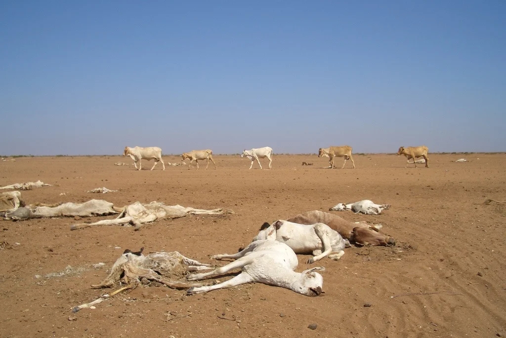
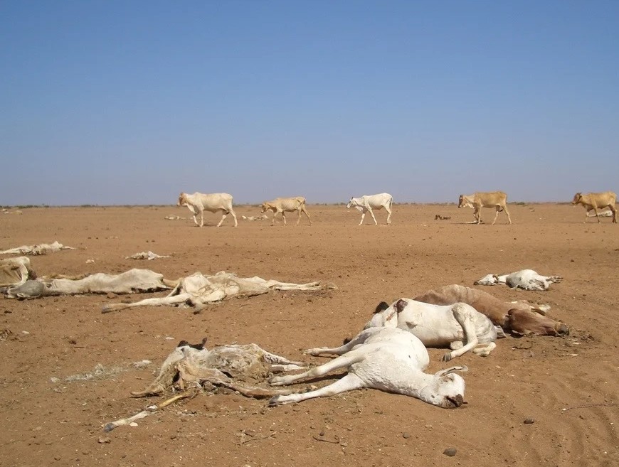
The 1997–1998 El Niño caused widespread global disruption. Economic loss estimates vary considerably across studies — a UN-backed assessment placed the range at $32 billion to $96 billion — and the event was linked to thousands of deaths worldwide through droughts, floods, fires, and disease outbreaks including malaria, Rift Valley fever, and cholera outbreaks across the Horn of Africa and Latin America. Indonesia experienced catastrophic forest fires, whilst severe flooding struck Peru, Ecuador, and parts of eastern Africa. California faced intense winter storms, and coral reefs suffered widespread bleaching events.
Which regions face the greatest impacts
El Niño’s effects vary dramatically by region, bringing devastating droughts to some areas whilst triggering flooding in others.
Drought-prone regions include Australia, Indonesia, southern Asia, the Philippines, Papua New Guinea, and much of Central America’s “Dry Corridor”. Southern Africa is particularly vulnerable, with the 2023–2024 El Niño causing severe drought across Angola, Botswana, Lesotho, Madagascar, Malawi, Mozambique, Namibia, Zambia, and Zimbabwe.
In contrast, flooding risks increase substantially in southern South America (particularly coastal Ecuador, Peru, and southern Brazil), the Horn of Africa, southern portions of the United States (especially from Texas to Florida), and parts of central Asia.
The WMO has specifically warned that the 2026 El Niño raises the risk of severe droughts in Central America and heavy rainfall in South America’s Southern Cone region.
Additional impacts include suppressed Atlantic hurricane activity due to increased wind shear, heightened wildfire risk in drought-affected regions (particularly Australia and Indonesia), widespread coral bleaching in tropical oceans, and significant disruptions to fisheries as nutrient-rich cold water fails to upwell along productive coastlines.
Agricultural impacts can be severe, with crop failures in drought zones potentially affecting food security for millions, whilst excessive rainfall and flooding destroy crops and infrastructure in other regions.
Climate change amplifying El Niño impacts
The developing El Niño comes against a backdrop of long-term climate warming, which research suggests may be increasing the frequency and intensity of extreme ENSO events compared to pre-industrial conditions. WMO Secretary-General Professor Petteri Taalas has previously stated that El Niño will “combine with human-induced climate change to push global temperatures into uncharted territory”, with far-reaching repercussions for health, food security, water management, and the environment.
ALSO READ: 2025 Records third hottest year as climate crisis deepens
Preparedness efforts underway
International humanitarian organisations and national meteorological services are coordinating preparedness measures, particularly in regions that suffered during the 2023–2024 El Niño. The United Nations Office for the Coordination of Humanitarian Affairs (OCHA) has activated early-warning systems in vulnerable countries.
In Latin America and the Caribbean, governments are pre-positioning relief supplies and strengthening early-warning systems for both drought and flood scenarios. Agricultural ministries are advising farmers on drought-resistant crop varieties and adjusted planting schedules.
The WMO will issue its next comprehensive El Niño/La Niña Update in late May 2026 to provide more detailed guidance for the June–August period and beyond, whilst NOAA’s next ENSO Diagnostics Discussion is scheduled for 14 May 2026.
Meteorologists emphasise that whilst the onset of El Niño appears increasingly likely, the ultimate strength of the event remains uncertain and will depend critically on atmospheric wind patterns over the tropical Pacific during the Northern Hemisphere summer months.
However, with ocean heat content already at near-record levels and multiple independent forecasting systems showing strong agreement on significant development, the global community is preparing for what could be one of the most consequential climate events in decades.
ALSO READ: Western Cape on high alert as Level 8 warning issued


You must be logged in to post a comment.