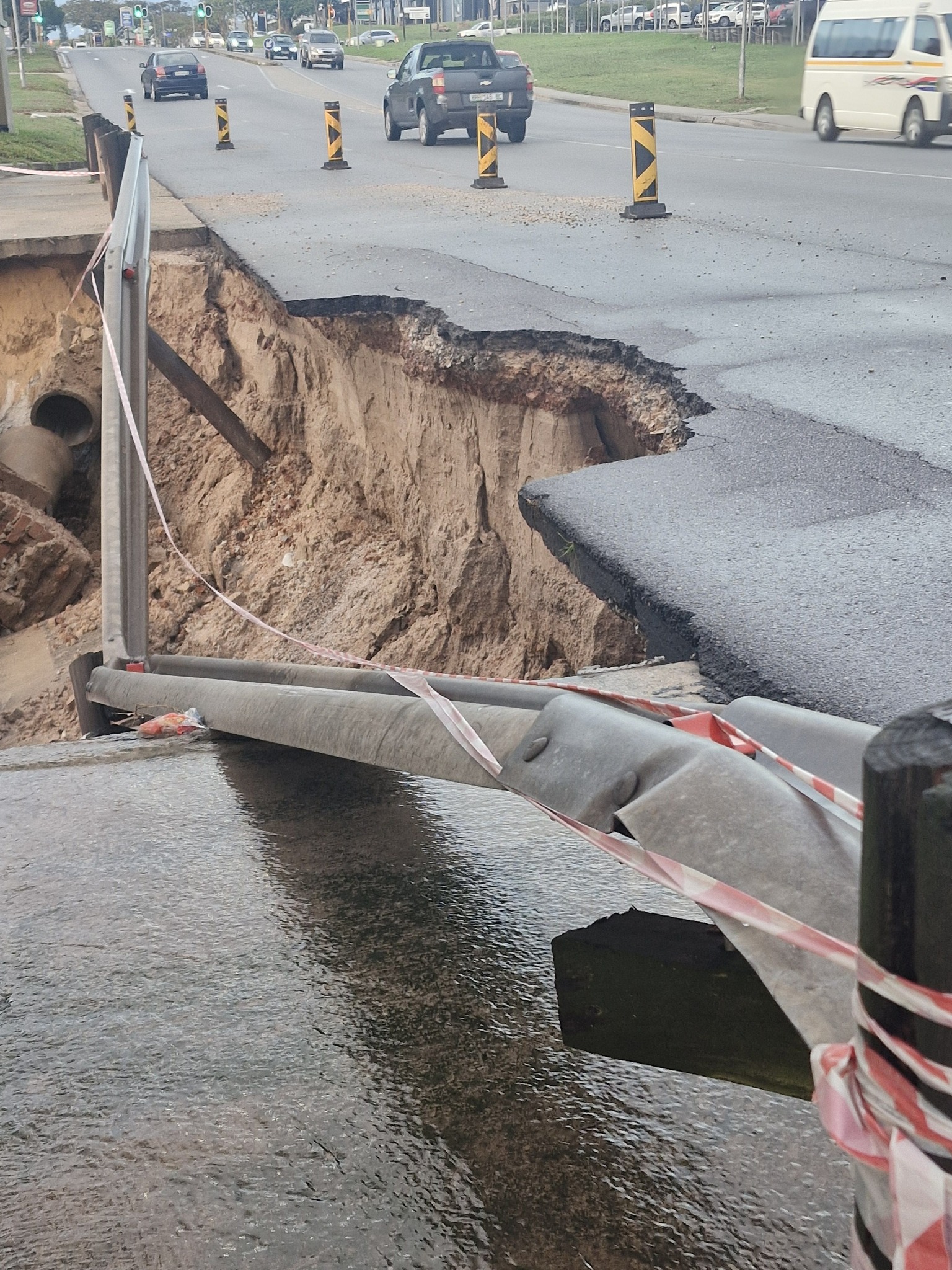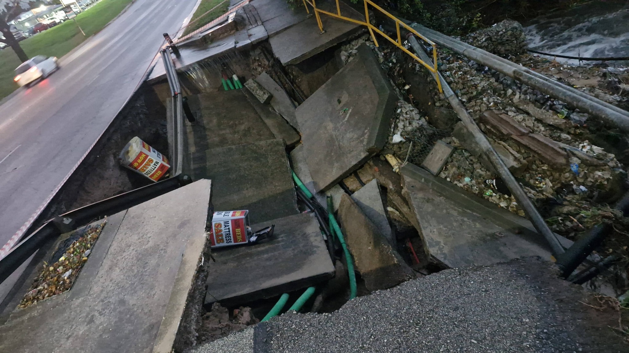
GQEBERHA – Widespread flooding continues across Nelson Mandela Bay as an Orange Level 8 weather warning has been issued, with more heavy rain expected and critical routes already affected.
Ward 6 councillor Gert Engelbrecht confirmed, in a social media post, that approximately 119mm of rain has already fallen in parts of the metro, with an additional 60mm to 120mm expected between 20:00 tonight and 05:00 tomorrow morning.
He also warned that the municipality will close one lane on William Moffett due to safety concerns.
The municipality has cautioned that “widespread flooding continues to impact several roads across the metro, resulting in closures and dangerous driving conditions,” urging motorists to avoid affected areas and use alternative routes.
Among the worst-affected areas, Mbane Street in Zwide is “heavily flooded on the bend from Johnson Road towards Nzondelelo High School and should be avoided completely.”
Veeplaas Road and Daku Road are closed, while Govan Mbeki Avenue near Pier 14 and the Malabar Bridge are both flooded.
Stanford Road is affected in multiple sections, including near Auto Cast Road and in Korsten. Durban Road behind Stanford Square is also flooded, with additional nearby areas impacted. The 3rd Avenue dip has been closed, and flooding has been reported along the William Moffett Expressway.
In Newton Park, 7th Avenue is flooded between Shirley Street and King Edward Street, while Newton Street is affected between 4th and 5th Avenue. Redhouse Road, connecting Uitenhage and Gqeberha, is “almost completely underwater.”
Further flooding has been reported along Walker Drive in Sherwood, at the corner of La Roche Drive and Strandfontein Road, and along the M4 between Deal Party and Mount Road. Target Kloof and the M17 in Swartkops are also flooded.
Additional affected areas include Chatty Dip, the entrance to Despatch, Highfield Road, Addo Road, and the N2 near John Tallant Road. Burt Drive behind Mercantile Hospital and Milner Avenue opposite North End Lake are also impacted.
Residents have been cautioned to avoid unnecessary travel, with the municipality stressing: “Do not attempt to drive through flooded roads, and remain alert at all times.”
Engelbrecht said no fatalities have been reported at this stage but urged residents to remain vigilant.
“Please note, we are not in the clear yet,” he said. “Residents are urged to prepare accordingly and remain cautious.”
Emergency teams remain on the ground, and further updates will be issued as conditions evolve.
Emergency Contact Numbers:
Municipal Emergency Response: 041 585 1555
Safety WhatsApp Line: 079 490 0480
ALSO READ: Orange Level 8 warning issued for Kouga and Kou-Kamma as flooding risk rises


")