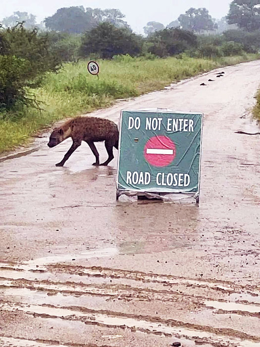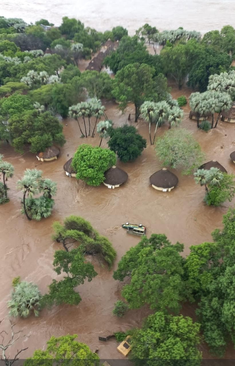
KRUGER NATIONAL PARK – Due to persistent heavy rainfall, staff and guests are being evacuated from the Letaba Rest Camp in Kruger National Park (KNP) after floodwater from the Letaba River entered the facility.
The Phalaborwa Gate will remain closed for at least 24 hours whilst the situation is monitored closely, meaning there is currently no access to the northern parts of the park.
Management has also taken the precautionary decision to suspend day visitor access until conditions improve.
In the meantime, a very serious and historic Red Level 10 impact-based warning has been issued by the South African Weather Services for disruptive rainfall to continue across parts of Limpopo and Mpumalanga for 15 and 16 January.
Several areas have already seen extreme multi-day rainfall totals (more than 500mm in places) with soils fully saturated and catchments overwhelmed and more rain still to come, the SAWS stated. It is predicted that some areas will receive as much as 300mm rain.
“The decision to restrict day visitor access is a preventative safety measure and will be reviewed continuously as weather and road conditions change,” said JP Louw, head of Communications and SANParks spokesperson, on Thursday 15 January.
SANParks is mindful of the current strain on operational and emergency response resources during this period of persistent rainfall. The organisation would prefer to focus available resources on genuine emergencies and ensuring the safety of guests, staff and surrounding communities, rather than avoidable incidents linked to non-essential travel within the park.
More on access routes
To ensure guests use the most direct routes to access camps and avoid closed routes, which is causing considerable frustration, guests should note the following guidance, Louw said on Wednesday:
- Access to Skukuza Rest Camp is recommended via Paul Kruger Gate
- Phabeni Gate is currently open but may be affected at short notice due to river levels. Updates will be provided when the gate is closed
- Access to Malelane Satellite Camp and Berg en Dal Rest Camp is via Malelane Gate
- Access to Crocodile Bridge Rest Camp and Lower Sabie Rest Camp is via Crocodile Bridge Gate. River levels are being monitored and updates will be provided should the gate become inaccessible
- Access to Orpen Rest Camp and Satara Rest Camp is via Orpen Gate
- Access to Olifants Rest Camp, Letaba Rest Camp and Mopani Rest Camp is via Phalaborwa Gate or Orpen Gate
- Pafuri Gate and Punda Maria Gate remain closed and are not accessible
Guests should also note that there is no access from Skukuza to Lower Sabie, Crocodile Bridge, Tshokwane and Satara as Sabie Low Water Bridge and detours are flooded.
Furthermore, there is no access between Lower Sabie and Tshokwane due to the H10 road being closed, and access to Pretoriuskop Rest Camp is via Numbi Gate or Phabeni Gate.
There is also no access to the far north of the park, and the situation remains unchanged.
SANParks sincerely apologises for the inconvenience caused by the persistent rainfall and appreciates the understanding and cooperation of the public during this time. The safety of all visitors and staff remains the highest priority.
Further updates will be communicated as the situation evolves, Louw said.
Warnings issued
People in high rainfall areas are requested to:
- Stay off flooded roads and low-water crossings
- Keep well away from fast-flowing rivers and flooded bridges
- Move to higher ground if flooding threatens your area
- Follow official instructions from local authorities and disaster management teams
Red Level 10 impact-based warning describes more disruptive rain with heavy downpours leading to widespread flooding of low-lying areas, resulting in closure of some bridges and major roads, widespread damage to settlements or structures over over a populated area.