
The South African Weather Service (SAWS) has issued a string of warnings ahead of a cold front, which is expected to hit large parts of the country with damaging winds, thunderstorms and hazardous sea conditions set to disrupt travel and raise safety concerns.
A level-two warning has been issued for strong, damaging winds over the northern parts of the Western Cape and the south-central Northern Cape.
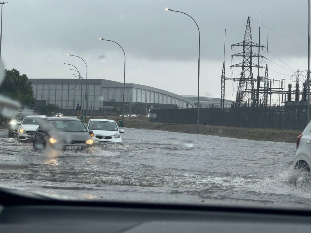
According to the SAWS, these conditions could lead to damage to infrastructure and settlements, while also posing risks to high-sided vehicles and potentially disrupting travel services.
Further inland, a level-one warning for severe thunderstorms has been issued for central and south-eastern parts of the Northern Cape.
The SAWS warns that heavy downpours and strong winds may result in localised flooding and damage to vulnerable infrastructure, particularly in informal settlements.
Another level-one warning for damaging winds remains in place for the south-eastern Northern Cape.
Adding to the risk, extremely high fire danger conditions are expected over the Central Karoo in the Western Cape, as well as parts of the Eastern Cape and southern Northern Cape, raising concerns over the rapid spread of veld fires.
The SAWS has also flagged an advisory for cold to very cold, wet and windy conditions expected to persist into Monday 27 April across parts of the Western Cape, including the Central Karoo, Cape Winelands, Overberg and the City of Cape Town.
Residents are urged to prepare for a sharp drop in temperatures accompanied by rain and strong winds.
Coastal areas are likely to bear the brunt of the approaching system. The SAWS said damaging winds are expected along the coast between Storms River and Port Alfred from early Monday morning, while gale-force offshore south-westerly winds are likely between Algoa Bay and East London.
Very rough seas, with wave heights of between 4 and 6 metres, are also forecast between Cape St Francis and East London, posing a risk to maritime activities.
Regional outlook
In the Western Cape, conditions will be partly cloudy and cool to warm, with isolated showers becoming scattered to widespread in the south-west. Coastal winds will be moderate to fresh, blowing from the west to north-west.
The Northern Cape will see cloudy conditions along the coast, with windy and partly cloudy weather inland, accompanied by scattered showers and thundershowers.
Elsewhere, the Free State and North West are expected to experience partly cloudy and cool to warm conditions with isolated to scattered showers and thundershowers.
Gauteng will start with morning fog in the south-west before clearing to partly cloudy and cool conditions, while Limpopo and Mpumalanga will also see cloudy skies with morning fog patches.
ALSO READ: Heavy rains: Western Cape not out of the woods yet, more rainfall predicted
In the Eastern Cape, conditions will vary between partly cloudy and warm with isolated showers in the west, to fine and hot in places in the east, though winds are expected to strengthen along the coast later in the day.
KwaZulu-Natal will experience morning and evening fog over the northern interior, otherwise fine and warm to hot conditions, especially along the north coast.
The SAWS has urged the public to remain alert to changing weather conditions and to heed warnings, particularly in areas prone to flooding, strong winds and rough seas.


You must be logged in to post a comment.