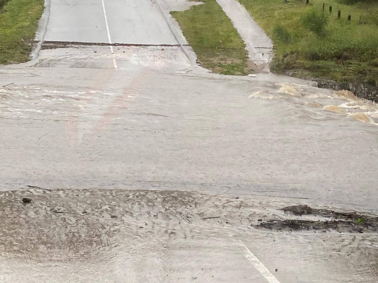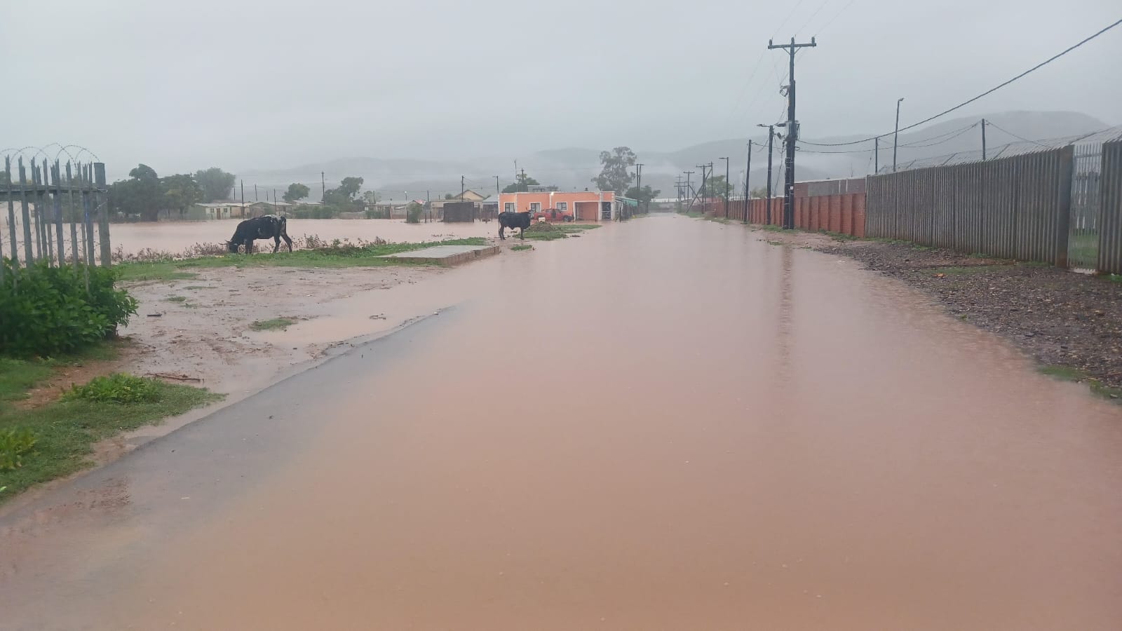
EASTERN CAPE – Heavy rains battering the western parts of the Eastern Cape have triggered a wave of road closures, rockfalls and flooding across the region, with both the Eastern Cape Department of Transport and the Kouga Local Municipality issuing urgent advisories as deteriorating conditions continue to pose a serious risk to motorists and residents.
According to the Eastern Cape Department of Transport, the R102 between Gqeberha and Jeffreys Bay has been closed to traffic due to rockfalls.
The route serves as an important alternative and parallel route to the N2, linking Gqeberha, the Gamtoos Valley, Humansdorp and Jeffreys Bay.
The R332 into the Baviaanskloof Nature Reserve has also been closed following heavy flooding.
“Contractors had only recently been working to restore access after the severe weather events experienced a fortnight ago, and the latest rains have unfortunately set those efforts back,” the department said.
Motorists are also advised of the following areas of concern:
- M17 behind the power station – significant water accumulation and severe potholes.
- Old Grahamstown Road near the police station – flooding reported.
- Addo Road under the railway bridge – closed due to flooding.
The department has indicated that it is closely monitoring mountain passes and other vulnerable sections of the road network.
“With soils heavily saturated, there are legitimate concerns about further rockfalls, mudslides and slope failures,” the department said.
“Driving conditions remain less than ideal, with wet and slippery road surfaces, standing water and poor visibility affecting many areas,” the department said.
The department further urged road users to exercise extreme caution, reduce speed, increase following distances and obey all road closure signs and instructions from traffic officials.
“The Eastern Cape Department of Transport will continue to monitor the situation and provide updates as conditions evolve,” the department said.
Meanwhile, the Kouga Local Municipality has issued a road closure and flood advisory indicating the closure of multiple roads including:
- Paradise Beach Causeway – Closed to all traffic due to the significant rise in water levels and unsafe crossing conditions.
- Kouga Bridge – The bridge is currently at full capacity with high water levels and is being closely monitored. Motorists are urged to exercise extreme caution and avoid unnecessary travel in the area.
Inaccessible roads:
- Mooi Uitsig Area – Several roads have become inaccessible due to flooding.
Motorists are advised to make use of the following alternative routes:
- Kraanvoël Street
- Johnsons Ridge
The municipality has also advised people not to cross the Weston Low-Water Bridge as water levels remain high. Road users are requested to make use of alternative routes where possible.
Public safety reminder:
- Do not attempt to cross flooded roads, bridges, or low-water crossings.
- Obey all road closure signs, barriers, and warning notices.
- Follow instructions issued by municipal officials, traffic authorities, and emergency services.
- Exercise extreme caution, as water levels and road conditions may change rapidly without warning.
The municipality has indicated that municipal teams continue to monitor all affected areas and will provide further updates as conditions develop.
“The safety of residents and visitors remains our highest priority,” the municipality said.
ALSO READ: Kouga roads closed after severe flooding and rising waters