
The wards and councillors will look very different after the upcoming November election, even if the same parties win back their municipal seats.
This is not only because ward boundaries are changing across the whole of Mitchells Plain but two of the previously elected ward councillors, Gouwa Timm and Danny Christians, are retiring from politics. Subcouncil 12 chair and Tafelsig ward councillor Solomon Philander will be stepping down as ward councillor but staying on as PR councillor, if reelected, while Westridge councillor, Ashley Potts, has opted not to stand for reelection.
Several new parties have also thrown their hats in the fray, including the curiously named Aboriginal Gorilla Fighters and the USA, which stands for United South Africa. The ATM party on the other hand are not related to banking, as their acronym suggests, because it actually stands for African Transformation Movement.
A Beacon Valley resident, Dawayne Jacobs, will also be taking his chances as a mayoral candidate for the One Love Alliance (OLA). The dreadlocked activist has publicly declared that despite the party having strong rastafarian representation, OLA is not a “rasta party”.
Online meeting
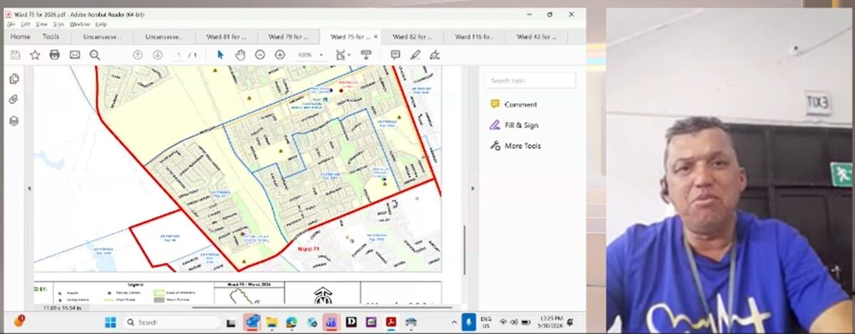
On Wednesday 30 September, councillors Potts, Christians and Avron Plaaitjies, held an online meeting with residents to outline the new ward demarcations.
Potts explained that the ward changes were determined by parliament and not by parties, the municipality or the Independent Electoral Commission (IEC).
The new boundaries do not affect voting stations or registration and Potts explained that residents who had moved but not reregistered in their new neighbourhoods would not be able to vote in those areas but would have to vote in the area where they had previously registered.
New ward boundaries
The new ward boundaries for Mitchells Plain’s suburbs are as follows:
- Ward 43 is bordered by Lukannon Drive in the south, Weltevreden Drive in the east, Govan Mbeki Road in the north and Strandfontein in the west.
- Ward 75 is bordered by Jakes Gerwel Drive in the west, the R300 in the north, the Cedars Avenue in the south and Eisleben Road, veering off into a piece of Morgenster Road, De Duin Road, Eros Road, Flora Road and Mitchell Avenue in the east.
- Ward 76 is bordered by the R300 in the north, Swartklip Road in the east, Morgenster Road in the south and the railway line in the west.
- Ward 78 is bordered by the R300 in the north, and Morgenster Road in the south. In the east, it has corners jutting into Highlands Village along Flora Road and in the railway line in the west.
- The jagged border of Ward 79 consists of the coastline in the south, Sentinel Road in the east, sections of Spine Road veering into Eisleben, The Cedars, Weltevreden Drive, jutting into Weltevreden Valley, in the north.
- Ward 81 is bordered by Spine Road in the south, AZ Berman in the east, Morgenster Road in the north, and Eisleben Road in the West. Ward 82 is bordered by Spine Road in the north, Lukannon Drive in the south, Swartklip Road in the east and Sentinal Drive in the west.
- Ward 116 is bordered by Morgenster Road in the north, Swartklip Road in the east, Spine Road in the south and AZ Berman Drive in the west.
Maps of all the ward boundaries are available on the IEC’s website.
ALSO READ: Political killings in South Africa reach record high ahead of local elections