KOUGA – The unprecedented flooding that swept through the Gamtoos Valley recently has been described as the worst flood event ever recorded at the Kouga Dam, with the dam rising from below 33% on 6 May to overflowing in approximately 18 hours.
According to Rienette Colesky, CEO of the Gamtoos Water Users’ Association, the dramatic rise in water levels followed days of intense rainfall across the catchment area and the Karoo region.
She said that they had been monitoring weather forecasts from 4 May, after becoming aware of a significant rain event expected across the catchment and downstream areas.
Colesky explained that they were aware of water travelling from the Karoo but that they were unable to obtain readings from the measuring weir at the time.
She further said that they knew that a lot of rain was falling in the catchment areas, but that they also did not expect the volume of water to increase as rapidly as it did.
However, by Wednesday afternoon, 6 May, water levels in the river system were still significantly below the danger threshold for low-level bridges.
Colesky said uncertainty remained around the Groot River catchment because of its size and the difficulty in predicting incoming flows.
“At about 16:30 on Wednesday afternoon, Stuurmanskraal, a measuring weir in the Kouga region, sent a signal that there was a higher than usual volume flowing over the weir,” said Colesky.
Shortly afterwards, she said monitoring systems at Stuurmanskraal and Condomo failed after being overwhelmed by the conditions.
“If it bombs out, it doesn’t send signals, and we can’t read it. These instruments are dependent on electricity and signals,” said Colesky.
She said that the scale of the flooding only became apparent during the early hours of Thursday, 7 May.
Colesky said she travelled to a nearby mountain viewpoint overlooking the valley basin and immediately realised the Groot River floodwaters had arrived overnight.
“I haven’t seen anything like this before, and I have been living in the Kouga region for 30 years,” said Colesky.
She said that at around 07:30 on 7 May, she received confirmation from staff that the Kouga Dam was spilling at 113%.
“The extent to which the dam filled up has never happened before. At 07:00 the previous day, Kouga Dam was below 33%,” said Colesky.
She said emergency preparedness plans were immediately activated, with notifications sent to the Department of Water and Sanitation, Kouga Municipality, agricultural users and residents throughout the valley.
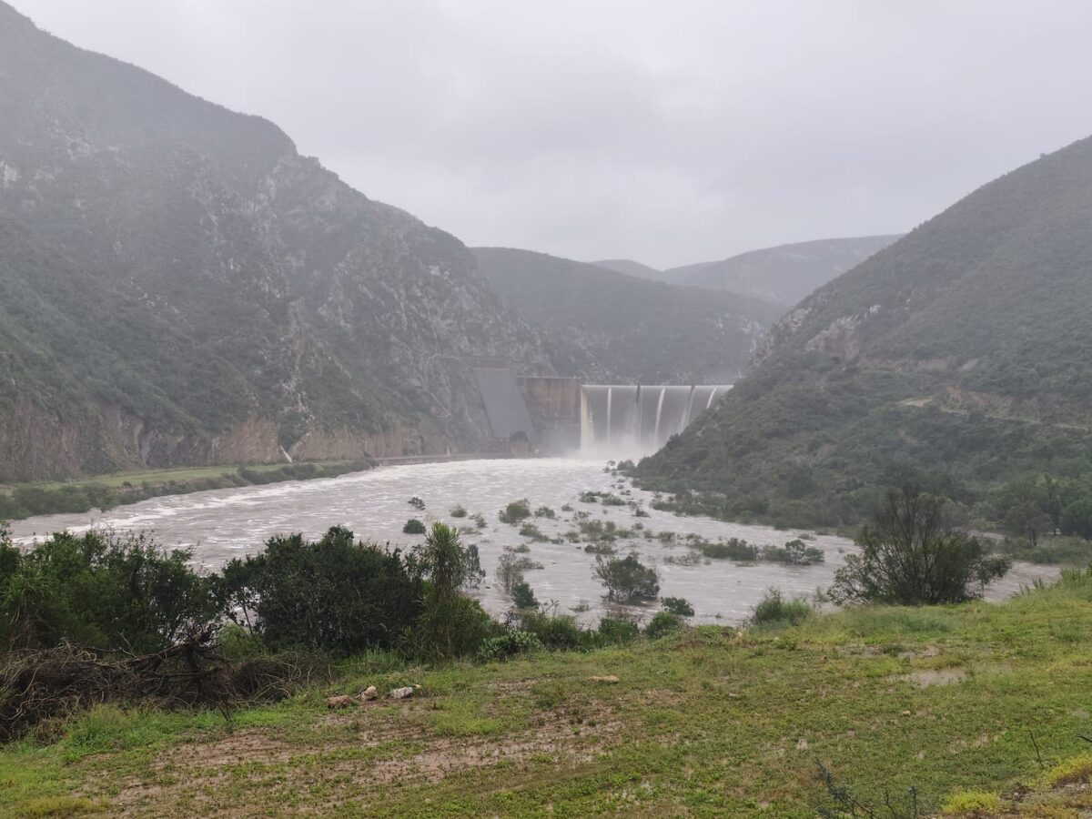
The municipality issued an urgent evacuation order for the Gamtoos Valley on 7 May after the dam exceeded full capacity and reached 113%, creating what it described as a serious flood risk to surrounding communities.
The evacuation order followed the South African Weather Service’s Level 8 warning for disruptive rain in the Kouga and Kou-Kamma areas, which remained in effect from 5 May at 10:00 until 7 May at 23:59.
Floodwaters rapidly spread across the valley.
Colesky said that at about 11:15 on 8 May, the water started filling up around Quagga, about eight kilometres from Patensie, and it flooded quite significantly and quickly.
“By the evening, the flood actually reached its maximum because most of the basin was flooded,” said Colesky.
She added that many citrus orchards were submerged during the flooding.
On 7 May, Colesky said that the dam reportedly reached 126% and released 3,700 cumec of water per second.
She said the volume and velocity of the water were difficult to comprehend.
“Our low-lying bridge closes at 33 cumec. To talk about 2.9 million litres of water, it’s very significant,” said Colesky.
“Possibly 2,249 elephants per second passing you. That is usually how we put it.”
Colesky confirmed that this was the largest flood ever recorded at the dam since its construction.
“The previous major flood was the 1996 flood, and it spilt at about 2,500 cumec. This flood spilt at 3,700 cumec,” said Colesky.
She said the speed at which the dam filled caught officials completely off guard.
“My guess was that one week after the rain, Kouga Dam would be spilling. We could never have predicted that it would spill a few days later,” said Colesky.
With electronic monitoring systems compromised by flooding and power failures, she said that officials had to rely on visual assessments and experience to guide decisions.
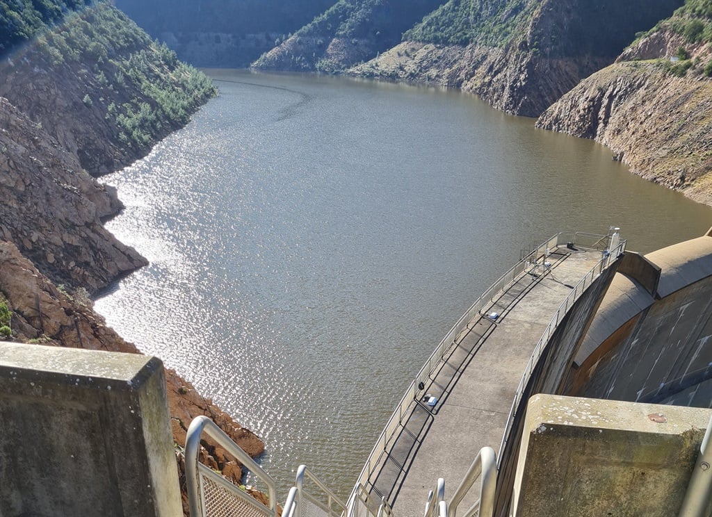
Colesky said that by Friday morning, 8 May, larger portions of the buttresses (the large concrete support structures that extend from the dam wall) became visible, indicating that the dam level was starting to drop.
She said that officials also gathered information from agricultural representatives upstream and later used drone footage and helicopter surveys to assess the scale of the flooding and identify additional water sources flowing into the system.
Colesky said that managing such an extraordinary event required making logical decisions based on the limited information available.
“This is the third flood I’m managing, but this is the flood with the most magnitude,” said Colesky.
“The Department of Water and Sanitation is also part of the communication process, but it was an extraordinary event.”
Colesky said that by 10 May, the dam level had decreased to 104%, while on 11 May it stood at 103%.
“We’ve been seeing that the system is actually dropping very quickly, which is unexpected,” said Colesky.
Despite the decrease, she warned that the surrounding area along the Kouga Dam remains dangerous due to damaged infrastructure, flooded low-water bridges and unstable river courses.
“Kouga Dam, at this moment in time, is not accessible because the road is not conducive to travel. There are quite a few roads that need to be fixed before then,” said Colesky.
She added that in several areas the river had carved entirely new paths through the landscape.
“The traditional course of the river has changed. In some places, it broke through where it never did before,” said Colesky.
Looking ahead, she said the disaster highlighted the vulnerability of communication systems during major emergencies, particularly during electricity outages.
Colesky suggested that older radio communication systems may need to be reconsidered in future emergency planning.
In a message to residents and farmers facing the aftermath of the disaster, she acknowledged the extensive losses suffered throughout the valley.
“Everyone in the valley has suffered lots of loss. I have a lot of empathy with all our agricultural users who lost large quantities of citrus orchards, pastures, or cash crops,” said Colesky.
“There is a lot of work to be done. It is not easy not to lose hope here, but I hope that every single person out there who needs to recover after this will have hope.”
According to the Gamtoos Water Users’ Association, the Kouga Dam was at 102.64% as of 13 May. The Groot Rivier ran at 62,150 litres per second on 13 May, an increase from 34,850 litres per second the previous day (12 May). This is increasing the volume in the system.
ALSO READ: Man dies after branch falls on him in his Bereaville yard