The Cliff Path is currently the talk of the town and in a response to Andrew Collins’ (chair of the PBRA) letter in the Hermanus Times (“Court action’s purpose to prevent access”, Hermanus Times 27 March) Jobre Stassen from the Cliff Path Action Group raised her concerns about the apparent lack of knowledge.
“The matter of property boundaries is a no-brainer; an updated, registered Surveyor General (SG) diagram will clarify all ambiguity and define the cadastral boundary of Bayview Property to inform both the homeowners as well as the Cliff Path Action Group,” she explained.
In emails that are in the possession of Hermanus Times the CPAG obtained information from experts in 2021 about the boundaries. Most of the SG diagrams were never updated.
“Since the promulgation of the Integrated Coastal Management Act 24 of 2008 various properties have been developed in Pooles Bay without their SG diagram being changed to correctly reflect the seaside boundary of these properties,” she explained. “Some of the diagrams dated from 1897, over a century ago”.
According to an expert from the Department of Forestry, Fisheries and the Environment the property owner needs to appoint a private land surveyor to do the survey. “Due to the high-water mark being an ambulatory boundary, National Geospatial Information (CD:NGI, under DALRRD) would need to be present for the survey. An SG diagram can only be ‘corrected’ by a land surveyor through instruction by the property owner. This amendment would then be submitted to the relevant SG’s office for examination and approval,” the expert stated in an email.
“It is concerning that not even the board of trustees of two properties in Pooles Bay, namely Bayview (erf 6337) and Mollergren Park (erf 6088), each with over 100 residents, has a clear understanding of their seaside property boundary – it remains a well-guarded secret in the hamlet of Hermanus. And that is my question: Why has they not employed the services of a professional land surveyor to address the shortcomings of an outdated SG? The diagram referred to in the title deed dates back to 1984, a period prior to the Integrated Coastal Management Act. That should clarify in the words of Collins ‘private law property rights’,” Stassen said in response to Collins’ letter in the Hermanus Times.
“Bayview is an apartment block consisting of 49 units. Many of these units are rented out. Without an updated SG none of these owners nor visitors have any idea where their property ends. An updated SG will keep all the underlying factors in mind and clarify to all parties concerned where the cadastral boundary is.
“Unfortunately only the owner of a property can update an SG diagram. The cadastral boundary of Bayview is the best kept secret in Hermanus and the source of conflict between residents of Hermanus for many years,” she explained.
According to Stassen the pool and braai area is adjacent to coastal public land that cannot be considered as private.
Collins is also concerned about the building plans of the Cliff Path connection whilst a letter from the Overstrand Building Department confirm their satisfaction with the building plans.
“The Cliff Path Action Group has an official Seashore Lease contract in place with Cape Nature in order to rent the land from the state where the Cliff Path is being build. The building plans needed to meet the satisfaction of our local authority before the lease contract with Cape Nature could be signed,” Stassen explained.
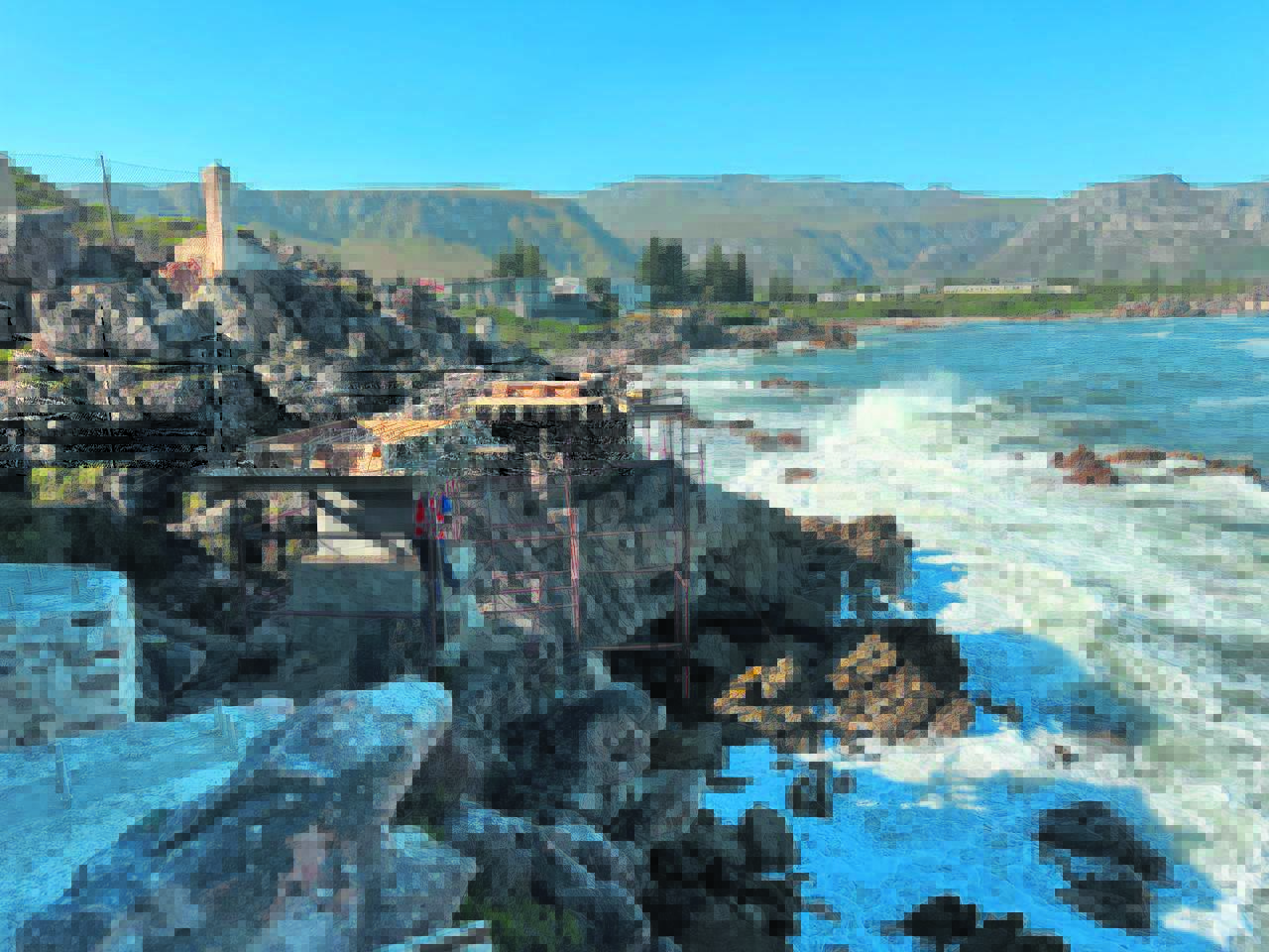
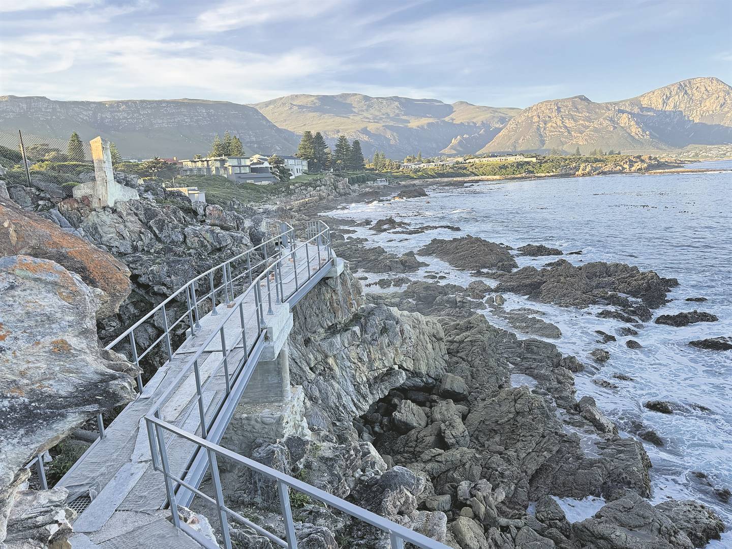
With the concerns about the safety of the Cliff Path, the CPAG is happy to announce that there is no damage to the new Cliff Path after recent storms. “Amazing structural work with a beautiful finish that blends in well with the rocks. Well done engineers, the Cliff Path is spectacular and will bring joy to many locals and foreigners who walk along the shore line,” a resident of Hermanus said on a WhatsApp group.. As the Cliff Path is one of Hermanus’s valuable tourist assets it is important to know who is making the enjoyment of this iconic walkway possible. There are currently two volunteer organisations working towards a better Cliff Path experience for all in Hermanus. Firstly, there is the Hermanus Cliff Path Management Group (CPMG) and secondly there is the Hermanus Cliff Path Action Group (CPAG).
The CPMG was formed in January 2002, laying the concrete path and drive initiatives to environmentally enhance, conserve, maintain and secure the Cliff Path.
The CPMG works under a co-management agreement with the environmental management department of the Overstrand Municipality and within the Fernkloof Nature Reserve Management Plan.
‘Historically, David Beattie, then chairman of the CPMG, raised substantial funds, and together with the Municipality’s contribution, maintained the Cliff Path.
“Unfortunately, the municipality, currently being under financial/resource constraints is not in a position to assist to the same extent as previously, yet it is a path directly supporting the tourism industry of the Whale Coast,” Stassen said. The CPMG is currently in dire need of public donations and funding for the average monthly path maintenance and certain special projects is the responsibility of a group of volunteers.
The CPAG is responsible for the construction of the 800-meter new section of the Cliff Path from Mollergen Park to Sea Road and raised public funds for this through their non-profit organisation. The CPAG fundraising efforts are separate from the maintenance of the remainder of the 12 km Cliff Path between New Harbour and Grotto Beach.